
Trace a Kailua Street Address
Begin with the physical address as USPS or the City and County of Honolulu writes it. Establish the parcel before trying to connect a name. Honolulu's Real Property Assessment Division, or RPAD, links a site address to a 12-digit Property ID or tax map key. That key, usually called a TMK, crosses assessment, planning, parcel mapping, and many recorded instruments. It also guards against confusing a street with a similar road elsewhere on Oʻahu.
- Enter the site address in the RPAD property search. Record the exact situs address, TMK, assessment year, and parcel class.
- Open the official HoLIS parcel layer. Match the polygon and TMK, then note whether it is tax and regulatory, tax only, or regulatory only.
- Use the TMK or address in the DPP permit search. Permit records date work, but a named applicant is not necessarily a resident.
- Carry the TMK or an RPAD sales instrument number to the statewide Bureau of Conveyances and follow recorded transfers.
- For an earlier household, inspect the Windward Register and Polk street sections, then confirm each name in another dated source.
This street directory chain separates four facts that are often blurred: a parcel's site, an address used for mail, a legal ownership interest, and actual occupancy. RPAD may display fee owners, lessees, exemption claimants, sales, values, and permits. HoLIS supplies map geometry and source fields. A deed proves that named parties took part in a recorded transaction. None of these facts alone says who lives there now.
Search Kailua Assessment Records
RPAD documentation confirms two sound starting keys: site address and the 12-digit TMK or Property ID. The current qPublic form was blocked during unattended research, so its exact owner-name controls and result order should not be assumed. Official record guides identify result areas such as Profile, Map, Values, Sales, Residential, Commercial, Outbuildings, Permits, Sketches, Photo, Buffer, and historic parcel history.
| Search key or field | Format | Street research use |
|---|---|---|
| Site address | Street number and name | Finds the physical Kailua parcel |
| Property ID / TMK | 12-digit identifier | Joins RPAD, HoLIS, DPP, and deed work |
| Mailing or c/o address | Result or notice field | Shows delivery, not the occupied site |
| Sales instrument | History field | Provides a bridge to a recorded document |
| Assessment year | Dated result | Separates current and prior rolls |
RPAD says online data updates Monday morning Hawaiʻi time, and amendments may carry double asterisks. Assessment data is not legal documentation. Save the date and field label, especially when an owner, lessee, or claimant appears. The mailing-address change form itself permits c/o and relocation changes, which is a clear warning that mailing and situs fields do different work.
Map Kailua Parcels by Street
The HoLIS All Parcels layer turns an address row into polygons. Its fields include parcel UID, TMK, zone-sector-plat, recorded area, subdivision name, source documents, developer lot number, and edit dates. Three types matter: combined tax and regulatory parcels, tax-only parcels, and regulatory-only parcels. A polygon touching another polygon is not always another home.
The official service below exposes the field structure behind the map.
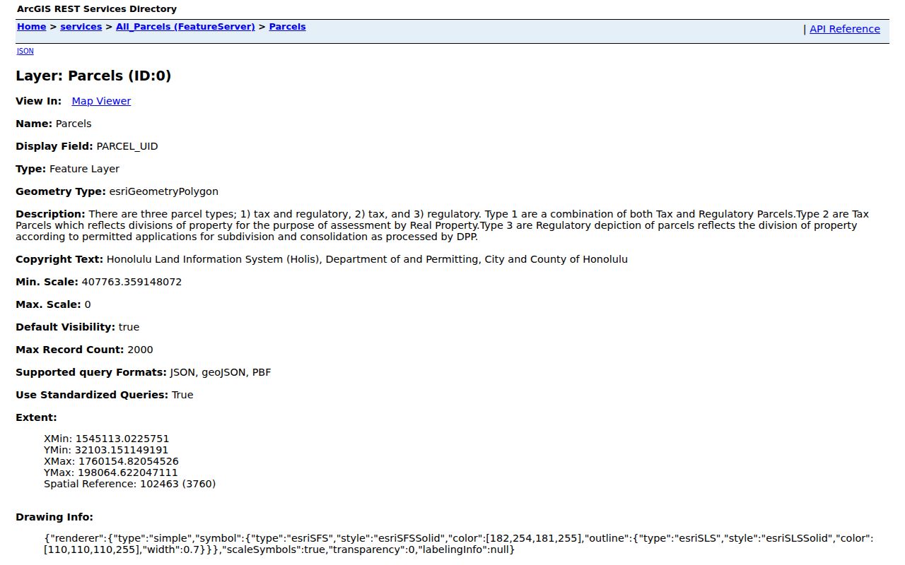
Use the map as a visual index. Boundary lines are reference geometry, not a survey, and assessment attributes can change. Match the TMK back to RPAD before drawing a conclusion. The state Oʻahu parcel service also says HoLIS is its current source, while an older Kailua and Waimanalo clipped item is only a 2021 snapshot.
Check Kailua Permits by Address
The DPP building permit search accepts application number, permit number, address, TMK, and date ranges. It can show when work was filed, how an address was written, or which parcel key belonged to a project. HNL Build is the current portal, while DPP's Data Access and Imaging Branch supplies a records fallback.
The public permit screen shows the fields worth copying exactly before widening a search.
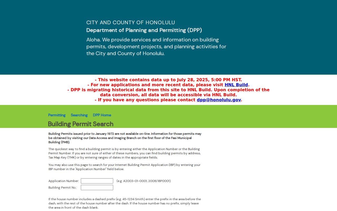
If the portal lacks an older file, call DPP at 808-768-8000 or DAIB at 808-768-8277, email dppdaib@honolulu.gov, or visit the counter at 650 South King Street. A focused UIPA request can describe the address, TMK, permit type, and date range. A permit applicant, owner, architect, and contractor can be different people, so preserve the role shown.
Which Kailua Records Run by Street
Each source answers a narrower address question. The RPAD and HoLIS pair establishes the parcel. DPP adds permit and address history. The Bureau of Conveyances supplies the legal instrument chain. Election tools describe precinct and ballot geography within strict privacy rules, while historical city directories may connect a printed name to an older address.
| Address record | Keeper | What it contributes | Access route |
|---|---|---|---|
| Assessment roll | Honolulu RPAD | TMK, site, mailing, values, and sales | Portal, office, or phone |
| Parcel layer | Honolulu DPP / HoLIS | Geometry, type, area, and source fields | Free ArcGIS service |
| Recorded instruments | State BOC | Grantor, grantee, document, date, TMK | Free index; paid image route |
| Election geography | County and State Elections | Ballot by address and limited public fields | OLVR and office channels |
| Building permits | Honolulu DPP | Permit, address, TMK, filing date | Portal, counter, phone, email, UIPA |
| Historic street guides | Archives and libraries | Dated printed names, firms, streets | Scans, books, microfiche, staff request |
TMK is the best join. Keep leading zeros and note that DPP, RPAD, HoLIS, and BOC may format it differently. A street name helps browsing, but the parcel key reduces false matches. For the full publication history, use the Kailua city directory collections rather than treating one old volume as complete.
Follow Kailua Deeds by TMK
Kailua deeds do not begin at a county recorder. Hawaiʻi records conveyances statewide through the Bureau of Conveyances. Its online index reaches from 1976. Search is free, while current document images use an account and payment route. Earlier work may require a written search form or research in Public Research/Reference Room 123.
A grantor gives an interest; a grantee receives one. Regular System and Land Court records are distinct, so keep the system shown. The index can expose a document number, type, date, names, and TMK. Copy the RPAD sales instrument and date, then follow BOC's document-number instructions. Call 808-587-0147 or email dlnr.bc.faq@hawaii.gov when online access fails. Mail search is another documented channel.
Instrument bridge. An RPAD sale may point to the BOC document, but a party to that deed is not automatically a Kailua occupant.
Kailua Street Record Terms
Street directory work crosses systems, and their labels are not interchangeable. Record the agency's own term before translating it into plain language.
- Parcel
- A mapped unit used for tax or regulatory work; it may not equal one dwelling.
- Situs address
- The physical site address, unlike an owner's mailing or c/o address.
- Plat
- A recorded map that describes lots, boundaries, or a subdivision.
- Criss-cross directory
- A directory set in street and number order so an address leads to a dated printed name.
HoLIS also separates tax, regulatory, and combined parcel types. That detail warns against counting every nearby polygon as a household. When an instrument refers to a legal description rather than a street number, the plat and TMK may be the only safe connection.
Kailua Streets in Print
The Windward Register gives Kailua a rare local clue. Official holdings describe an annual Kailua, Oʻahu run from 1958 to date, with classified business and professional material plus a street-guide map. Exact volumes and reverse sections need a librarian check because current Kailua branch holdings were not itemized.
Start with the volume nearest the target year and move backward. Search its alphabetical section, street guide, business classes, civic groups, and advertisements. A name may appear under a spouse, firm, or group rather than as a householder. Keep the printed spelling and town label, since older records may file Kailua under Oʻahu, Honolulu, Koʻolaupoko, or another period geography.
The State Archives points to Polk and Husted books and selected eVols scans. Kailua Public Library at 239 Kuulei can help identify branch access. The Hawaiʻi State Library's Hawaiʻi and Pacific Section and State Archives hold broader runs. Ask staff for title, year, format, and copy rules before a visit. No separately titled Kailua criss-cross run was found, so never invent reverse coverage.
Kailua Streets and Voter Limits
The OLVR address ballot search takes an island, address, and CAPTCHA. It returns ballot and candidate geography, not names registered at a house. Under HRS section 11-97, full name, district or precinct designation, and voter status form the public set. Other affidavit data remains confidential except for authorized election or government purposes.
For a Honolulu voter record question, contact City Clerk Elections at 530 South King Street, Room 100, or 808-768-3800. State Elections handles statewide administration and OLVR. A request should identify the election purpose and record type, not seek identity numbers, signatures, or the whole affidavit. Online registration confirms or updates the requester's own status; its identity fields do not create a public street directory.
Limits of Kailua Street Records
A public street directory cannot prove every person in a Kailua home. RPAD is an assessment roll, not an occupancy census. A mailing address may belong to an owner, agent, trust, or c/o recipient elsewhere. A deed names legal parties at a past date. Permits can name an applicant or contractor. Historical directories omit people and may list a firm, mailing point, or group instead of a home.
Utility customer records and motor vehicle address data are not open resident lists. Most voter-affidavit details are also protected. A no-hit may mean a move, name variation, unlisted household, missing volume, or portal gap. Date every item, keep negative searches, and confirm a conclusion with a second official source.
Lawful use. Kailua address records support personal, lawful research. Never use an address trail to stalk, harass, threaten, or defeat Hawaiʻi's Address Confidentiality Program.
When no index exists, send a focused request under the Hawaiʻi Uniform Information Practices Act. Name the agency, address, TMK, record type, and date range. The normal response target is ten business days, with a possible extension to twenty for extenuating circumstances. UIPA does not override statutory confidentiality.
Office access can also solve a Kailua street directory portal gap. RPAD serves the public at 842 Bethel Street in the basement and at 1000 Uluʻohia Street, Suite 206, in Kapolei; its information line is 808-768-3799. The Bureau of Conveyances research room provides the earlier recorded-instrument route, while DPP keeps its counter at 650 South King Street. Bring the same address and every known TMK form to each office. A staff search is more useful when it includes the parcel's assessment year, the likely document range, and whether the request concerns a permit, subdivision, conveyance, or assessment record.
Address spelling deserves its own Kailua street directory audit. The Honolulu Neighborhood Board street index records street and house-number ranges, ZIP information, and board geography, but those lines do not prove who occupies a parcel. USPS may label a nearby address as Waimanalo under 96795 while Kailua generally uses 96734, and postal, CDP, board, and parcel boundaries do not perfectly align. Preserve the exact postal result and the government record's own place label. If they differ, explain the boundary issue instead of forcing both records into the same locality.
Historic and current parcel identifiers also need careful transcription in the street directory. RPAD may show a 12-digit Property ID, DPP may use an eight-digit TMK style, and HoLIS exposes normalized TMK fields plus zone, section, and plat components. Condominiums can add a CPR suffix. Losing a leading zero or suffix can send the street search to a different interest. Save each display form beside the source URL and date, then use the agency's format when searching that agency.